

Silence not an option as China encroachment persists
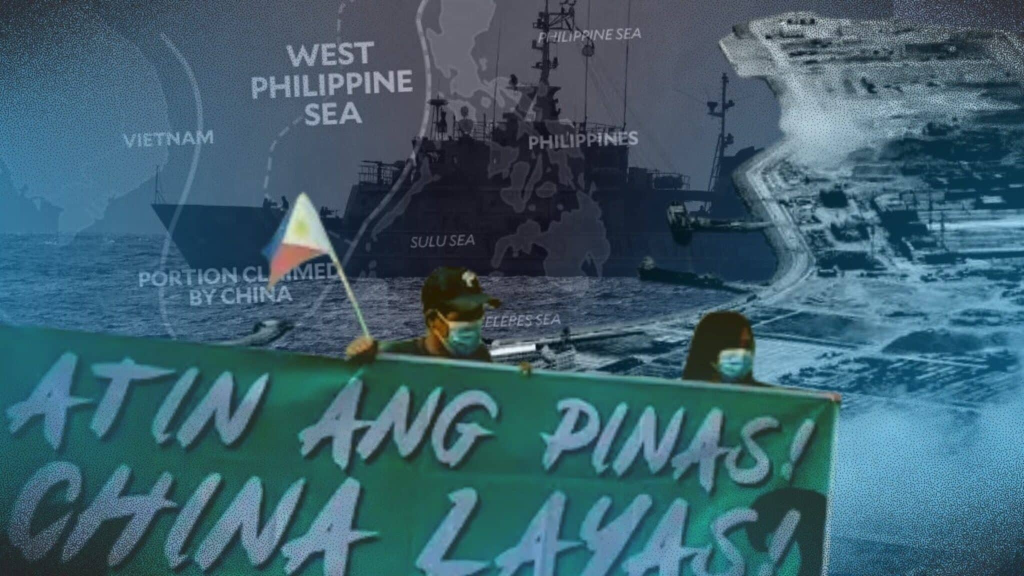
WEST PHILIPPINE SEA composite image from INQUIRER.net
MANILA, Philippines—With China aggressively insisting on the legality of its baseless nine, now 10-dash line, which covers almost the entire South China Sea, one can only imagine what a swarm of vessels could do to advance its occupation.
Based on latest data from the Asia Maritime Transparency Initiative (AMTI) of the Center for Strategic and International Studies, China has kept a constant presence in the South China Sea in 2024, staying in other countries’ waters for 1,939 ship days.
AMTI said this is longer than the previous record of 1,652 in 2023.
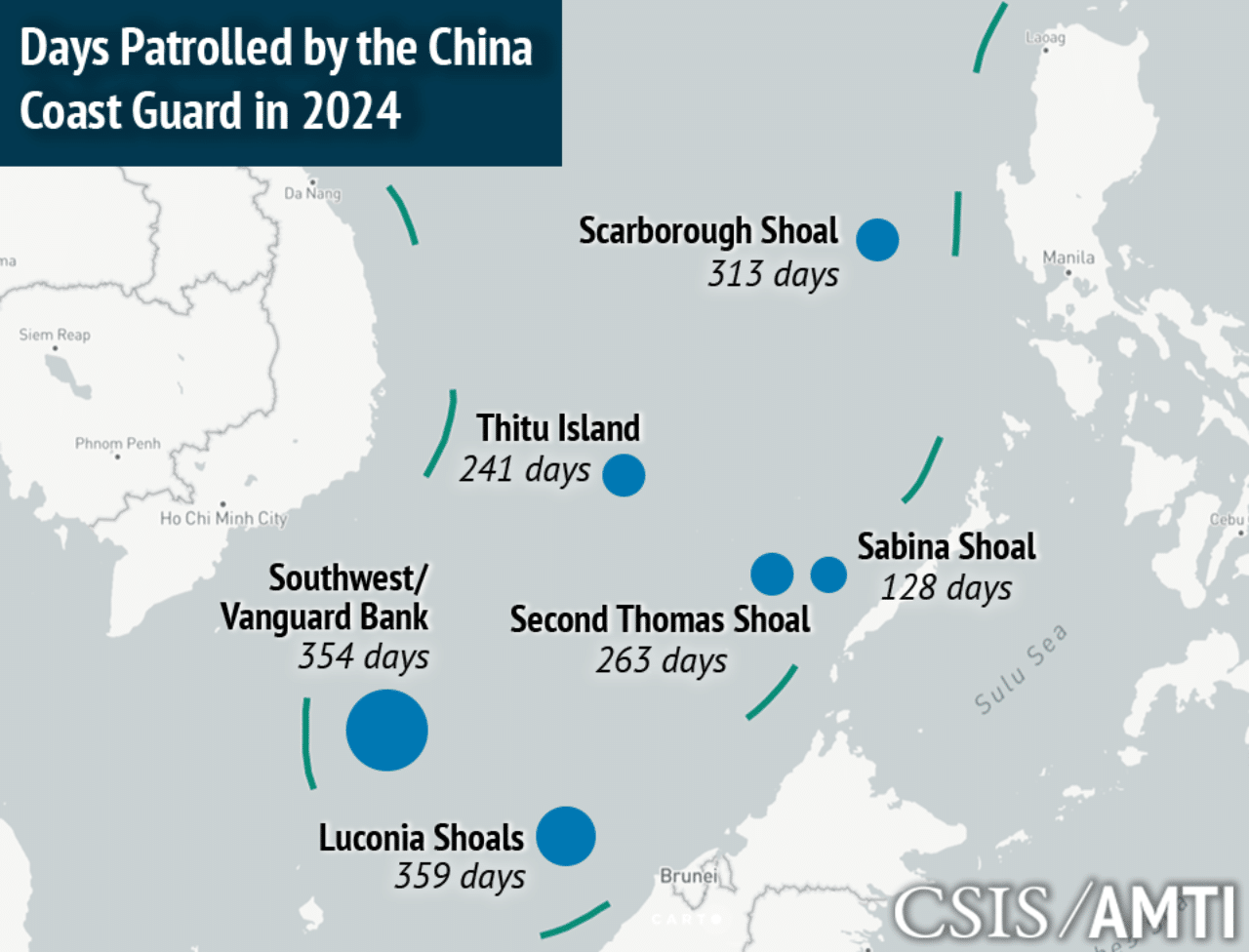
GRAPHIC: Asia Maritime Transparency Initiative
China’s vessels had stayed the longest in Luconia Shoals for 359 days and Vanguard Bank for 354 days. They were seen, as well, in Scarborough Shoal for 313 days; Second Thomas Shoal for 263 days; Thitu Island for 241 days, and Sabina Shoal for 128 days.
READ: Before Escoda collision, China increasing presence at Ayungin
As pointed out by the AMTI, the China Coast Guard (CCG) “is as active as ever in patrolling every corner of its vast claim in the South China Sea,” which has parts that fall within the exclusive economic zones (EEZs) of several countries.
The Philippines has protested this, especially China’s aggression against Filipino vessels, which in some instances, has endangered men from both the Philippine Navy (PN) and Philippine Coast Guard (PCG).
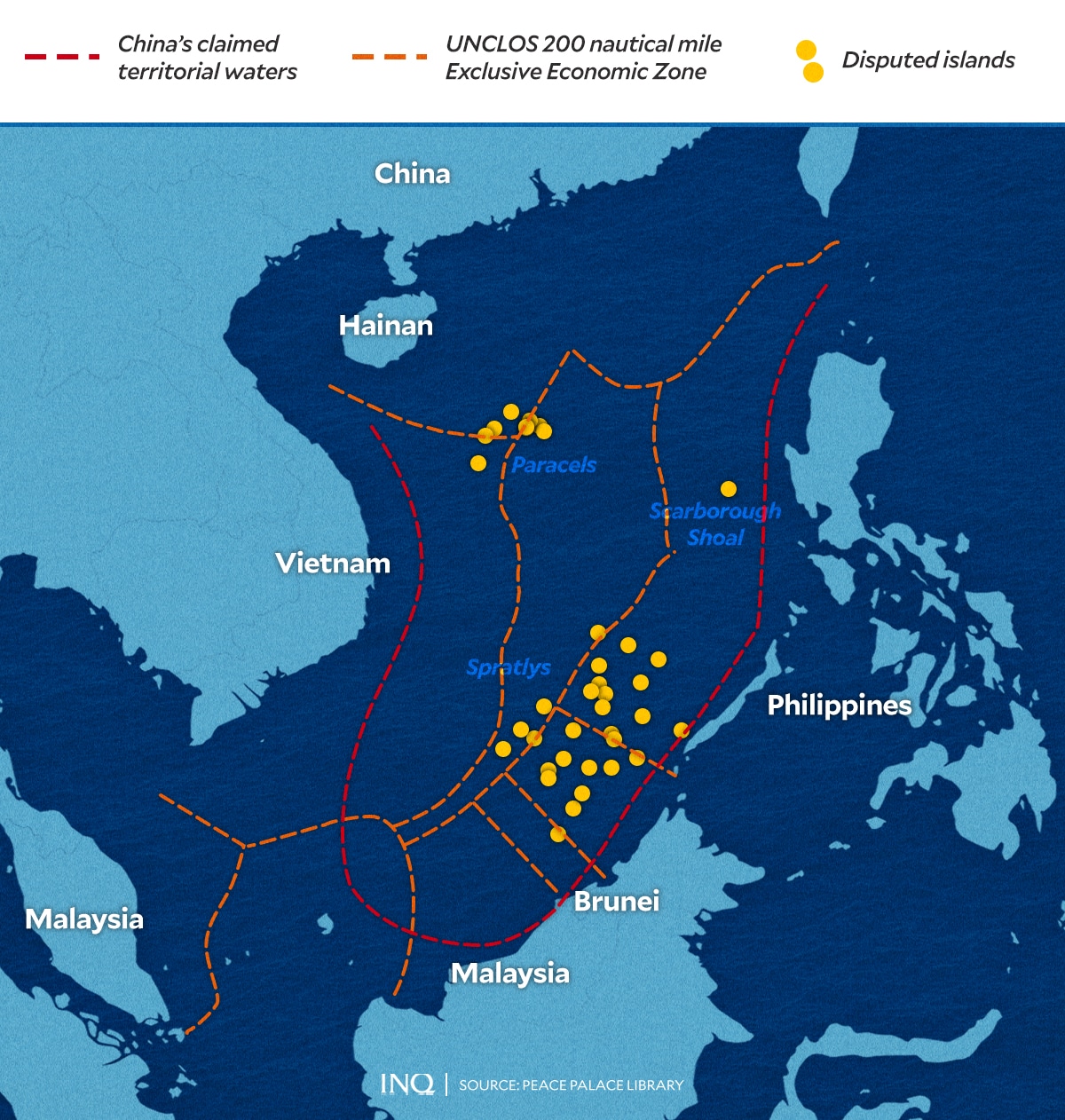
GRAPHIC: Ed Lustan/INQUIRER.net
Likewise, even with China’s presence in Luconia Shoals, Malaysia said it will still proceed with oil and gas exploration within its EEZ, including the activities at the Kasawari Gas Development Project off Sarawak in Malaysia Borneo.
READ: Malaysia gets taste of China West Philippine Sea bullying
Vietnam broke its silence, too, as it demanded the release of its fishermen and vessels believed to have been illegally captured by the Chinese in the Paracel Islands, where it has conflicting claims with China and Taiwan.
READ: Vietnam learns lesson about China aggression – everyone’s a target
But China has one constant response—its actions are legitimate, saying that all other states asserting their respective rights over parts of the South China Sea “infringe” on its sovereignty even though it only has the nine, now-10 dash line as basis.
The dashed line has already been invalidated by an arbitral court in 2016.
China has its ways, however, with international relations analyst Dr. Elaine Tolentino previously pointing out that “it does look like no amount of diplomacy is working to prevent China from its ambitious claims in the South China Sea.”
“It does it simply because it can,” she had told INQUIRER.net.
Based on a list by the AMTI, China has 20 outposts in the Paracel Islands and seven in the Spratlys, but in a bid to legitimize all of these, China is believed to be taking a grip of strategic features in the South China Sea.
As early as 2017, then Supreme Court Associate Justice Antonio Carpio said Sandy Cay, a sandbar close to Thitu, or Pag-asa Island, which is occupied by the Philippines, was “being seized” or “being invaded” by China.
But Rodrigo Duterte, who was still the president then, downplayed the allegation, stressing that there is no need to fight over a sandbar. “China assured me that they will not build anything there,” he had said.
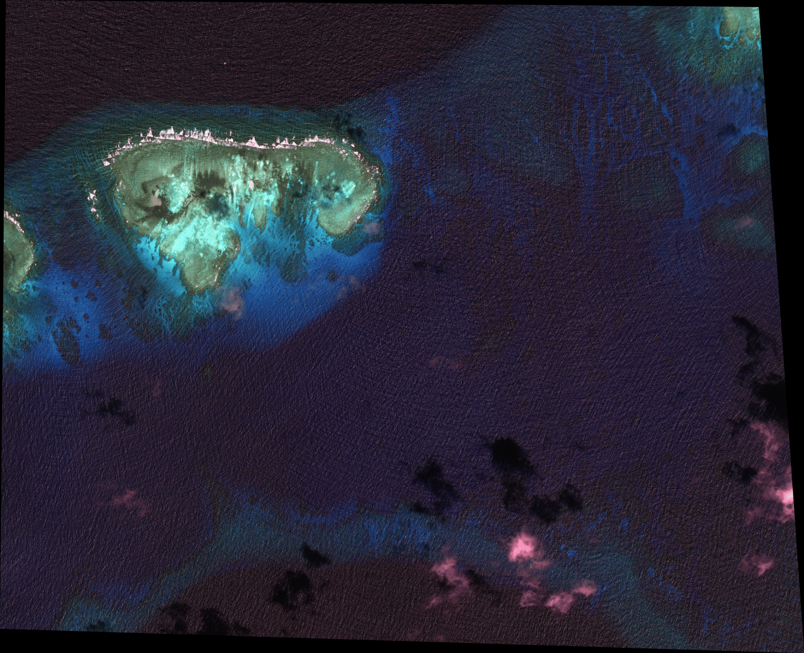
While China did as it promised, Dr. Jonathan Anticamara, a professor from the Institute of Biology of the University of the Philippines discovered “rubble piled on Pag-asa Cays 1, 2 and 3 and are now exposed even in high tide.”
Pag-asa Cay 2 is Sandy Cay, which is now above water at high tide and is entitled to a 12 nautical mile (NM) territorial sea designation, which is the sovereign territory of a state, maritime policy analyst Dr. Mark Valencia had said in an analysis published in 2019.
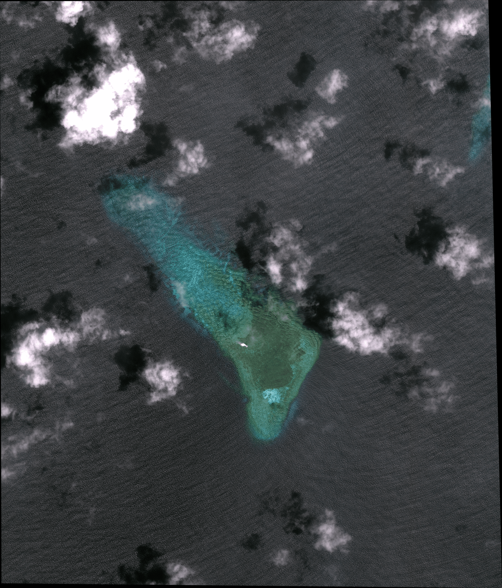
Sandy Cay year 2012
Sandy Cay, a sandbar close to Philippines-occupied Thitu Island and China-occupied Subi Reef, is in a “degraded” state, marine scientist Jonathan Anticamara said last year, with the National Task Force for the West Philippine Sea pointing to China as “suspect.” Anticamara, however, shared that there are a string of possible natural and man-made reasons behind the existence of “rubble” in the sandbar, which is now bigger compared to how it looked in 2012, based on images obtained by INQUIRER.net from US-based satellite image provider Apollo Mapping.
While Anticamara said there is still a certain degree of uncertainty as to how rubble piled up on the sandbar, National Task Force for the West Philippine Sea spokesperson Jay Tarriela said the government has a “suspect.”
He had stated on X that if he would be asked who is behind what he described as “illegal small island reclamation,” he would stress that “there is no other country that we can pinpoint.”
“It’s only the People’s Republic of China,” he said.
Back in 2022, a Bloomberg report pointed out that China has been carrying out reclamation at some features in the Spratly Islands, which were previously not occupied—Sandy Cay, Lankiam Cay, Eldad Reef, and Whitsun Reef.
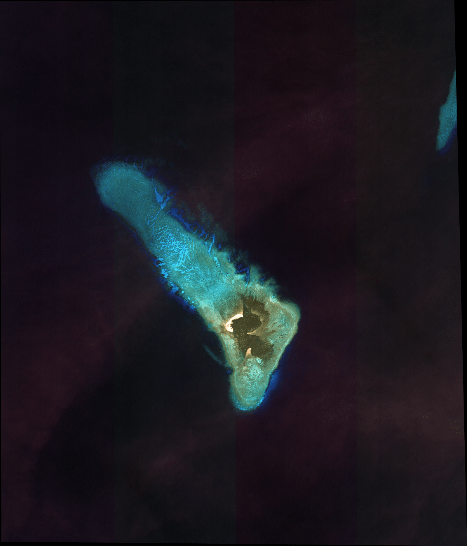
Lankiam Cay year 2012
Lankiam Cay, the smallest of the naturally occurring Spratly Islands. As the Naval Forces West of the Philippine Navy said, it once had a surface area of 5 hectares, but strong waves and strong typhoons eventually washed out the beach of the island, “leaving behind the calcarenite foundation that can be seen at low tide,” as seen on images obtained by INQUIRER.net from US-based satellite image provider Apollo Mapping. But a 2022 Bloomberg report said the island is being developed by China, an allegation immediately dismissed as “fake” by the Chinese government.
China, however, dismissed the report.
Anticamara explained that he is “not 100 percent certain” how the rubble piled up but he observed something “weird or not common,” saying that the sandbar in Sandy Cay did not look like other islands that were naturally formed.
“When I went there, it seemed like there were still live corals that were piled with a lot of rubble that were so whitish and did not yet have algae that it looked like they were newly piled,” he told INQUIRER.net in a recent interview.
He said, however, that there is a string of possible reasons behind this.
It was stressed in The Maritime Review that although Sandy Cay is small, “its value is tremendous” from a legal perspective, saying that it is classified as a rock that can generate a territorial sea where a state can assert sovereignty.
Valencia had pointed out that “given the sweeping claims to parts of the South China Sea, ordinarily a dispute over the ownership of a sandbar would not be a big deal.” However, Sandy Cay is strategic.
“It so happens that the sovereign of these sandbars would significantly enhance its strategic and legal position in the area, especially since sovereignty over a territorial sea extends to the airspace, seabed, and all associated resources.
As stated in The Maritime Review, if Sandy Cay did not exist or there were no high-tide features in Thitu Reef’s western atoll, demonstrating sovereignty over Thitu Island would suffice to gain a claim to Subi Reef,” which is occupied by China.
READ: Defending West Philippine Sea: The abyss separating Duterte, Marcos
It pointed out that to bolster its claim over Subi Reef, where a 394-hectare artificial island has been created with a three-kilometer military grade runway and a seaport, China has to demonstrate sovereignty over Sandy Cay.
The Philippines, conversely, has to exercise sovereignty over Sandy Cay to claim Subi Reef and extinguish any legal ground for China’s occupation and construction of an artificial island on the feature.
READ: PH to file diplomatic protest vs China Navy’s dangerous WPS maneuvers
Valencia explained that the stand of the Philippines is that China’s sovereignty claim to Subi is invalid and that it lies within its EEZ and on its continental shelf. The problem, however, is Subi Reef lies within the 12 NM territorial sea of Sandy Cay.
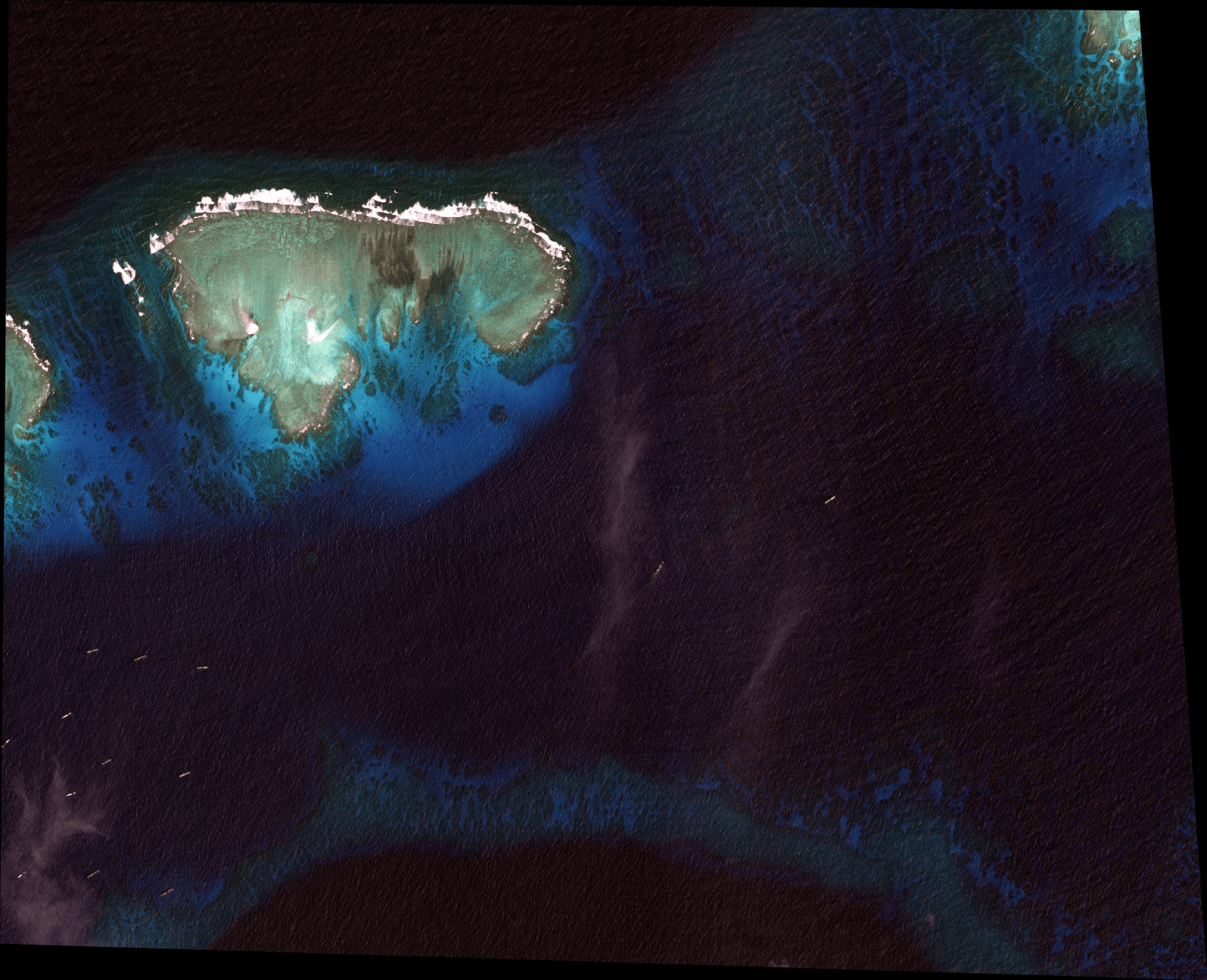
But this is not an exclusive concern of the Philippines, as sandbars seem to be coming to sight permanently in Luconia Shoals, where Malaysia’s Kasawari Gas Development Project can be located.
Since 1963, Malaysia has exercised sovereignty over Luconia Shoals, and in 1974, the government incorporated the state-owned energy company Petronas and vested in it the rights to explore and produce oil and gas.
GRAPHIC: Ed Lustan/INQUIRER.net
China, however, stated in a two-page diplomatic note in 2024 that the oil and gas exploration “infringes” on China’s sovereignty over both the north and south Luconia Shoals, where the Luconia and Seahorse Breakers are located.
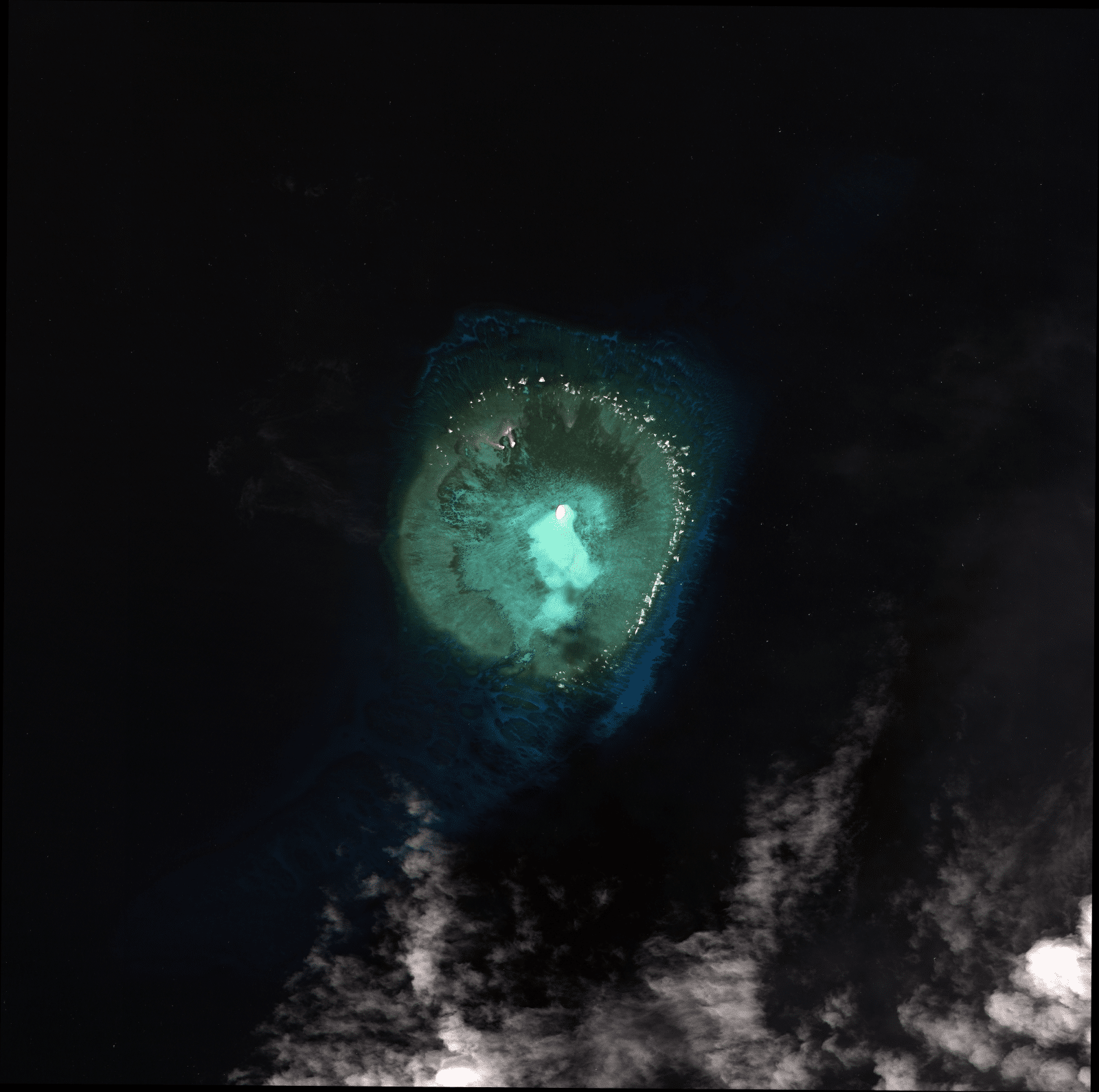
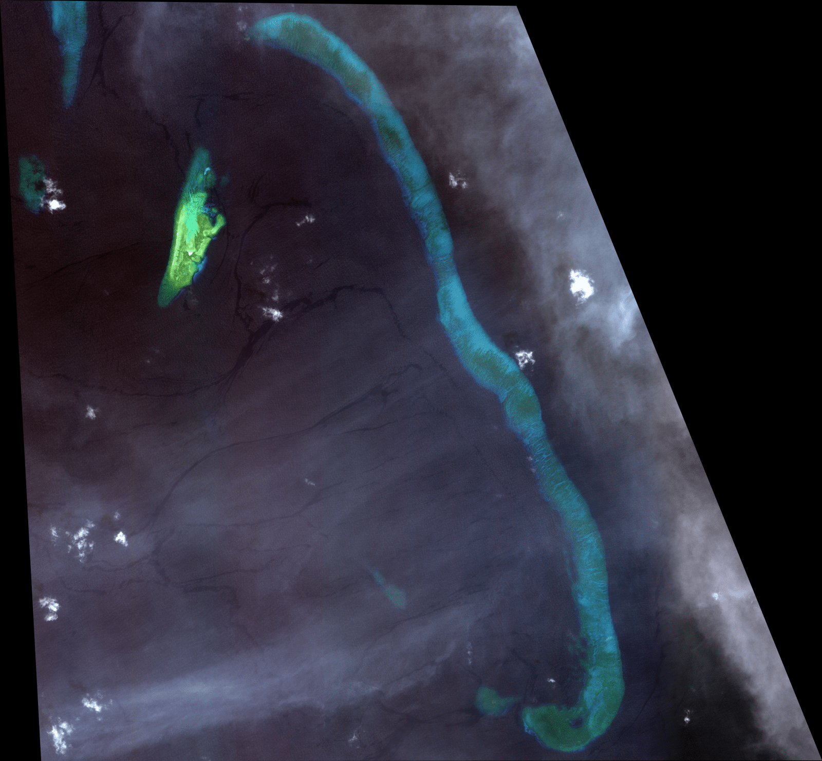
Luconia Breakers year 2011
Luconia Breakers, located in the South Luconia Shoals, which is often “patrolled” by Chinese vessels, as the Asia Maritime Transparency Initiative said, and close to the Kasawari Gas Development Project off the state of Sarawak in Malaysia Borneo, shows signs of expansion, based on images obtained by INQUIRER.net from US-based satellite image provider Apollo Mapping, although it is not clear whether the expansion was because of natural or man-made reasons.
The Luconia Shoals are over 380 NM away from China-occupied Fiery Cross Reef.
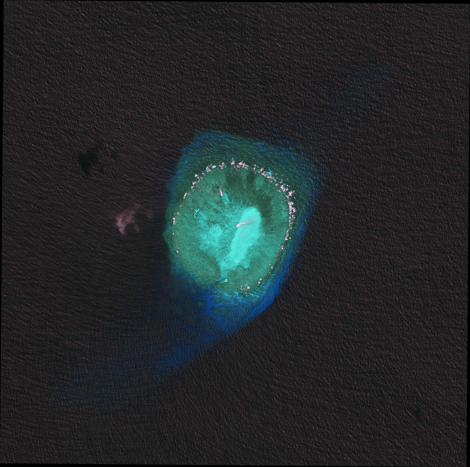
Seahorse Breakers year 2011
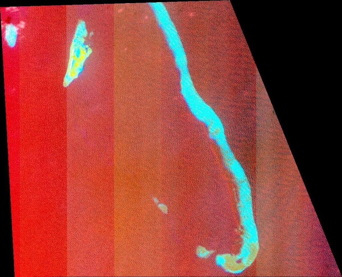
Seahorse Breakers, located in the southernmost part of the Spratlys, in North Luconia Shoal. The overviews are from 2011 and 2024, based on images obtained by INQUIRER.net from US-based satellite image provider Apollo Mapping
From July 2022 to February 2025, the Philippine government already filed 203 diplomatic protests against China, with the most recent ones lodged because of what has been described as illegal Chinese presence inside the EEZ of the Philippines.
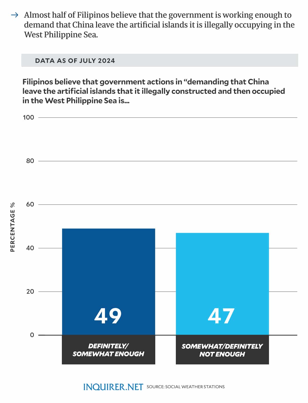
As of July 2024, 49 percent of Filipinos believe that government actions in “demanding that China leave the artificial islands that it illegally constructed and then occupied in the West Philippine Sea” is “definitely or somewhat enough.”
GRAPHIC: Ed Lustan/INQUIRER.net
Malaysia has previously filed diplomatic protests against China, as well, although it has been silent over the diplomatic note sent by China to the Malaysia Embassy before INQUIRER.net published it on Aug. 29 last year.
As pointed out by defense analyst Chester Cabalza, president of the think tank International Development and Security Cooperation, “although point blank diplomatic protests against China are still effective, it should evolve to diplomatic dialogue to resolve problems.”
The Philippines’ National Security Council had said there is an intense backing for the government’s stand in the West Philippine Sea, with 91 percent of Filipinos aware of the conflict between the Philippines and China.

GRAPHIC: Ed Lustan/INQUIRER.net
Some 84 percent back the government’s efforts to defend the West Philippine Sea.
Cabalza told INQUIRER.net in a recent interview that China and the Philippines, as well as the other claimant states like Malaysia, have to be “open for more critical and frank communication to find solutions in the big puzzle of strategic contestations.”
This, as geopolitcal analyst Don McLain Gill, a lecturer at the De La Salle University, previously stressed that even “when we talk about having a diplomatic solution” to the conflict with China, “this does not mean that we will be letting go of our capacity to defend ourselves based on international law and our interests as a sovereign state.”
READ: China opposes PH maritime zones law, says it violates territorial sovereignty
But because China’s bullying strategies have worked for its expansionist goals without resulting in actual conflict, as stressed by defense analyst Elaine Tolentino, the Philippines “should creatively find ways to impose actual costs on China that would question its power illusion that it is, at the moment, uncontested in its grey zone tactics.”
In 2024, China “strongly condemn[ed] and oppose[d] the enactment of the Philippine Maritime Zones Act and the Philippine Archipelagic Sea Lanes Act, saying that the laws “severely violate China’s territorial sovereignty and maritime rights and interests in the South China Sea.”
READ: Diplomatic protests vs China no longer enough to push ships out of West PH Sea – Bayan Muna