


Marcos orders use of local names for Kalayaan Island Group features


MANILA, Philippines — President Ferdinand Marcos Jr. has ordered that more than 100 geographical features in the Kalayaan Island Group (KIG) in the West Philippine Sea bear local names in government documents and official maps.
Under Executive Order (EO) No. 111, issued on March 26, Marcos ordered the adoption of a standard set of Philippine names for the 131 features of the KIG, part of the Kalayaan municipality in Palawan province, including islets, sandbars, atolls, reefs, shoals, and sand cays.
A copy of EO 111 has not yet been published on the Official Gazette website.
According to a news release from the Presidential Communications Office, EO 111 directs the National Mapping and Resource Information Authority to produce and publish updated charts and maps reflecting the names set in the issuance.
It also orders all national government agencies and instrumentalities, including government-owned or -controlled corporations and government financial institutions, to use the names set forth in the EO in all official communications, messages, and documents.
The EO also directs the Department of Education, Commission on Higher Education, Technical Education and Skills Development Authority, and all state universities and colleges to use the standard names in educational and training institutions, particularly in conducting research, publishing textbooks, and preparing educational or instructional materials.
READ: DFA endorses PH names for 131 Spratly features
The National Maritime Council (NMC) last year recommended adopting a standard set of Philippine names for the features of the KIG.
According to the NMC, adopting these names is “imperative to ensure efficient administration and governance of the area and to exercise the country’s sovereignty in the WPS.”
The Department of Foreign Affairs said providing standard Philippine names for KIG features “will help demonstrate the Philippines’ right to name such features within its sovereignty, sovereign rights, and jurisdiction under the United Nations Convention on the Law of the Sea.”
It would also formalize the use of these names by government agencies and further implement Republic Act No. 12064, or the 2024 Philippine Maritime Zones Act.
Under RA 12064, the maritime zones of the Philippines on the western side of the Philippines archipelago, including the Luzon Sea and the territorial seas of Bajo de Masinloc, and the maritime features of the KIG, shall be collectively called the West Philippine Sea.
READ: West Philippine Sea: Naming and necessity
Located west of Palawan, KIG is a group of features and their surrounding waters that belong to the Philippines, located in what is internationally known as the Spratly Islands.
The Kalayaan municipality was created in the KIG under Palawan province by virtue of Presidential Decree No. 1596 issued by then-President Ferdinand Marcos Sr. in 1978.
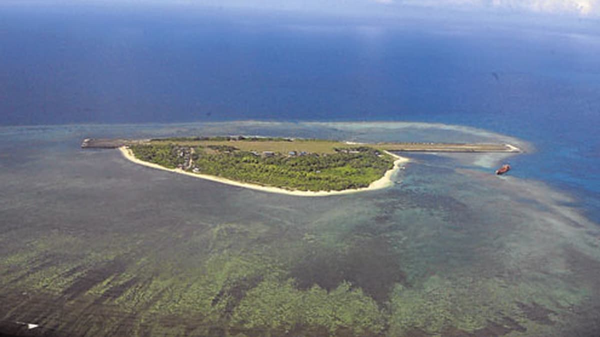
The Philippines has occupied nine features in the KIG since the 1970s: Rizal (Commodore) Reef; Patag (Flat) Island; Panata Island (Melchora Aquino Cay/Loaita Cay); Kota (Loaita) Island, Ayungin (Second Thomas) Shoal, Likas (West York) Island, Lawak (Nanshan) Island, Parola (Northeast) Island, and Pag-asa (Thitu) Island.
Pag-asa, the largest island in the KIG, serves as the town proper of the Kalayaan municipality. It is about 280 nautical miles away from Palawan’s capital of Puerto Princesa. /mcm


