


NMC: Google Maps tag of West Philippine Sea reflects growing acceptance


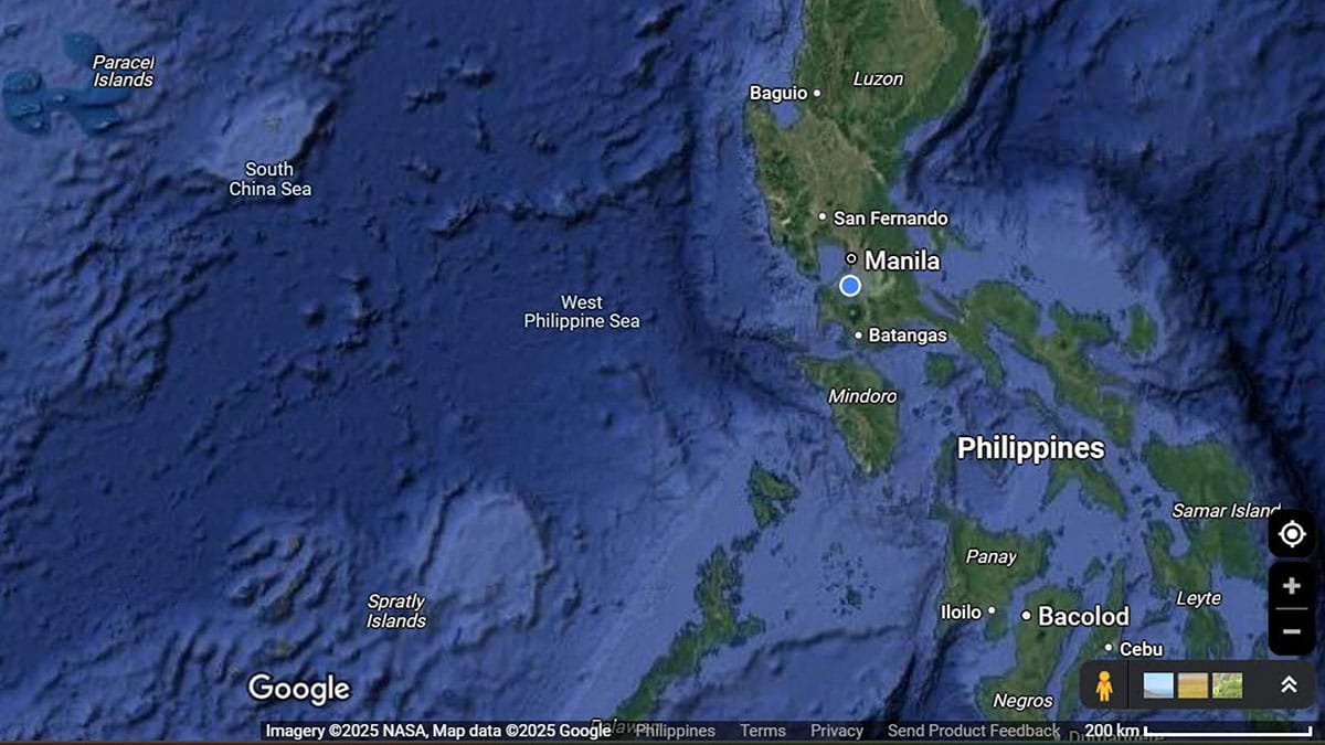
LABELING MATTERS Just three words in a field of blue are enough to elate a nation, although Google says they’ve been there all along and only made “easier to see.” —GOOGLE MAPS SCREENGRAB
MANILA, Philippines — The labeling of “West Philippine Sea” on Google Maps reflected the “growing acceptance” of the waters as part of the country’s sovereignty, according to the National Maritime Council (NMC).
Social media users and government agencies took notice on Monday that the digital mapping navigation platform was using the West Philippine Sea designation in the western section of the country’s exclusive economic zone (EEZ).
“We look at this initiative of Google Maps as a reflection of the growing acceptance that the waters of the West Philippine Sea are within our sovereignty, sovereign rights and jurisdiction,” the NMC said in a statement on Friday.
“It is also a recognition of the practical value of our national prerogative to name our own maritime zones, which will hopefully help encourage consistency in the term’s use by the international community and facilitate the upholding of the freedom of navigation in the West Philippine Sea,” the council added.
READ: West Philippine Sea seen on Google Maps
The waters of the South China Sea within the western section of the Philippines’ EEZ was renamed as the West Philippine Sea in 2012 through an administrative order by then-President Benigno Aquino III.
The renaming was part of an effort to assert Manila’s sovereignty over the waters amid continued aggressions by Beijing.
Aquino’s order also directed the National Mapping and Resource Information Authority to show the West Philippine Sea in charts and maps of the country.
A 2016 Permanent Court of Arbitration ruling affirmed the Philippines’ claim of the West Philippine Sea.
For comprehensive coverage, in-depth analysis, visit our special page for West Philippine Sea updates. Stay informed with articles, videos, and expert opinions.


